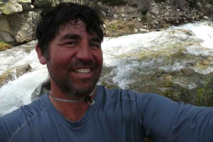
Day 11 (7/9/2017)
In no time I had cleared the tree line, but to my chagrin it was snow fields and rock outcroppings; moreover, snowfields meant no trail to follow. The map showed the trail looping around some hills and then gradually climbing up to Pinochet Pass. I opted instead to climb to the top of the hill to get a better vantage. As I reached the top of the hill there was rock out cropping, I looked back to see a lone coyote snooping around where I took a rest. I knew it wouldn’t follow me through the snow field to the pass. I continued forward. I found myself tiring easily on this ascent. It wasn’t steep, but it was long, and through snow. The ascent to the pass was simple compared to Glenn. While at the top, a marmot joined me until a playmate arrived. I hustled down until I lost my way. There were a series of small ponds, frozen with rocks outcroppings and snow drifts. I wandered a bit amongst the ponds, always heading down. I grew weary, I was so tired on this day. I was tired of getting lost, I was tired of the snow, I was tired of power bars. I laid down on rock and decided this was it.
And that didn’t last long, I got cold. I crossed a ice bridge, and headed down. Down past Marjory Lake, down past Mine Creek through the switchbacks. The rush I was hearing was Steep Mine Creek. I carefully picked a spot. Upstream and Downstream were too steep. It had to be here.

I crossed. The water was knee-thigh deep, but fast moving. I gave myself a pat on the back by picking such a good spot. The rocks right before broke the strength of the current. There was solid footing. I was getting good at this. I walked on.
That’s when I started to hear it. South Fork Kings River. It drowned out the sound of Mine Creek quickly. I walked up to the trail crossing and immediately thought: “No Way”. Before me was a good 20 yards of river — fast and deep. Debris was being swept down. It was the biggest river I’d seen on my trip. I looked down, in the sand was an arrow pointing up stream. I started to walk upstream. Dozens of people had passed me so far, I didn’t see any of them returning back. They must have made it. I stopped periodically bank side looking for a better place. Various paths took me to the edge of the river. At each one I looked down into the clear water and looked across. Could I make it here? Finally I chose a spot where the width narrowed to 15 yards ahead of a split in the river. I could see bottom. A path ended here. Someone must have crossed here and made it. I could too.
I decided to keep my boots on for traction. I zipped up my camera in a plastic bag. I took a deep breath and I put one step in, and slide right up to my crotch, with the current almost sweeping me off my feet. I jumped out. Holy Crap! I was not going to cross here. I moved a little more to where the river split around an island. I figured the current would be less. I started.
I faced the current in a three point stance with my poles shaking like rubber bands in the wind. The current was so strong it pushed me back. Sliding along the rocks in the riverbed, I started to shuffle my feet gently going with the current. I was leaning full force into the current and it still pushed me down stream. I shuffled quicker. Each time I picked a pole up SWISH, back I and to stab it quickly back into a new spot to avoid it being washed down. Water pushed against my belly, splashing me in the face making it difficult to see. I dared not wipe my face, instead keeping my arms pressing the poles into the riverbed in an attempt to make myself more sturdy. I finally made it to the center island. Despite the cold, I was sweating. My legs throbbed and my arms ached. Half way there. I rested a bit and then walked up and down the island looking for a place to cross the other half.
I decided on a section that had a log rock jam upstream. I figured this would lessen the force of the water. I started. I was wrong. The force was even greater than the other half I had crossed. I moved a little quicker. Part way through, I then noticed I forgot to remove my pants which increased drag. With another step, the channel got deeper with me sinking up to my diaphragm. I started to panic. Was I close enough to jump for it? I inched a little farther and it got a little deeper. I decided to jump for it. I lunged to to the edge.
I didn’t account for the force of the water and the river pushed me down. My fingers of my left hand caught the top of a sapling with I grasped with all I had. The current whipped my back against the rocks. As soon as I hit my right hand found a crevice in a boulder and dug in. The current whipped me around again and slammed my front into the edge. My right hand held. My left found another hold and dug in. I pulled my self up on the edge. I was soaked with freezing water and sweat. I crawled onto the river bank. I did a quick inventory. My shin split open, but I still had all my gear. Whew!
I stumbled away from the deafening roar of the river and started to look for the trail. Nothing but avalanche debris. I made my way northward up the Bench valley, crawling over down pines and firs. Walking up hill to get around them if I couldn’t get under or over them. I climbed over some boulders. No boot tracks, no trail. Finally, after the avalanche area subsided I glimpsed sight of part path in between snow drifts. I followed it’s directions to a rocky area where I sat down, took off my pants, boots, socks, and shirt to let them dry. I sat in the snow and the sun eating a power bar. I almost lost it….but I didn’t.
After awhile I pinned my wet socks to my pack to dry, and put on my other pair. My pants were mostly dry, and my shoes would dry as I walked. I started out again. In half a mile I came to another river. This tributary to the South Fork of the Kings River ran down a steep section of the mountain. A slip at the crossing point would wash me back into the South Fork of the Kings River. I walked up stream looking for a better crossing point. Still no boot tracks, pole spike holes, or paths to indicate where others had crossed. Snow lined the banks of this creek making it especially difficult to determine depth and what the bottom was like. I picked a spot and crossed.
Just my luck there were three more tributaries just like it. I was exhausted. I reached in my pocket for my snack, and the plastic zip lock full of nuts. To my dismay it was also full of water. What a day. The sun was getting low, and I had made very little progress. I hustled up the hill towards Mather pass.
I came to the Upper South Fork of the Kings River and saw group on the other side. I motioned to them inquiring where they had crossed. The pointed to a spot.
I rushed to setup my tent as thunder had started. My pants, socks, and boots were all soaked. I hung them up hoping the wind would dry them. The rain started, so I got in my tent and skipped dinner.
Miles Completed: 8
Elevation Changes: +2460, -2060
