Getting there
Travel is about many things to many different people. For many travelers an increase in personal wealth along with the rise of low-cost flights has moved many away from trains and bus travel, especially for long routes. Greyhound offers a 72 hour ride from Miami to Seattle, but there is very little data on long-haul bus routes.
The bus ride from Tijuana to Tepic Mexico was billed online as a 24 ride. It turned out to be about 30-31 hours. It’s a different group of people who travel by bus. My seatmate, was truck driver in Modesto and was traveling to visit family. Most people chatted with their neighbors and friendly and polite (well who wants to sit next to somebody for 30 hours who you can’t stand). Some passengers recognized others, new friends were made, and several people exchanged phone numbers to stay in touch.
There was a steward and she made regular announcements about rest stops, upcoming stations, and when it would be necessary to collect funds for greasing the palms of inspectors. There were many toll booths but my seatmate told me that going south has only one real checkpoint where they inspect everything. Going north there are five. Our steward was super charismatic and friendly and everyone liked her as she chided the old men for flirting, joked with the kids, and cracked jokes with women . We made three rest stops and 14 stops for pick ups and drop offs and four stops at random places to deliver packages. At each station there was a big shuffle. Almost everyone got off to make sure there luggage wasn’t passed off to wrong person.
In another two hours (35 miles) from Tepic I arrived in San Blas. It was well past check in time, but the hostel sent someone out to give me keys)and give me the lay of the land.
San Blas – Una Pueblo Magico
The Mexican Government identifies town with significant historical, cultural, or natural significance as pueblos magicos. (Magical Towns) It drums up tourism and gives the town a chance to showcase its highlights. Brochures and internet snaps show some of the main streets which look clean full of festive decor, and friendly shops.

However just a few streets over the streets look more like this:

San Blas, like a great many towns around the world have a small golden zone, and much larger gritty and real look. It’s not that it’s “fake”, it’s emblematic of where communities wish to put investment. Even though there are a great many buildings that are a state of perpetual improvement and some that have been abandoned altogether. The topical look aside, the people are beautiful, everyone says hello. When eating, strangers will wish you a good meal (“provecho”). When birding, people often invited me on property, or gave me recommendations on where to go look, or where interested in what I was documenting.
If food is your thing, this is a great town to come to. I ate some delicious vegetable enchiladas at the Wala Wala (in the picture above).

I also had some great food at a local shop where I saw the taxi drivers eating. This taco bar was to die for…..However, there was also plenty of seafood, ceviches, and meaty bounties to be found everywhere!

Historically, San Blas was the major port of the Spanish returning from the Philippines. On the hill I visited the old fort. Complete with the ruins of church built in the the 1740s.

From a rest and relaxation standpoint, it also has a massive shoreline. I also walked along the beach to the point. Even though the walk is short (three miles round trip), in the 90 degree heat it was a lot.
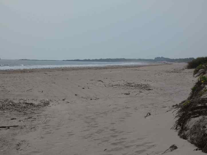
Many people drive their jeeps on the beach out to the point to fish where the San Cristobal river meets the pacific and churns up food for fish. For the first half mile there were restaurants touting fresh seafood. Although I passed on the ceviche, there was a lot of fish being cooked and eaten. The beaches were wide and there was ample room for everyone. The large marina offered a variety of fishing and snorkeling options as well as a ferry to The Maria Islands (Which used to be a penal colony, but transformed to a wildlife refuge, and then to a wold heritage site). The visit is pretty commercialized so I skipped it.
Some Natural Wonders
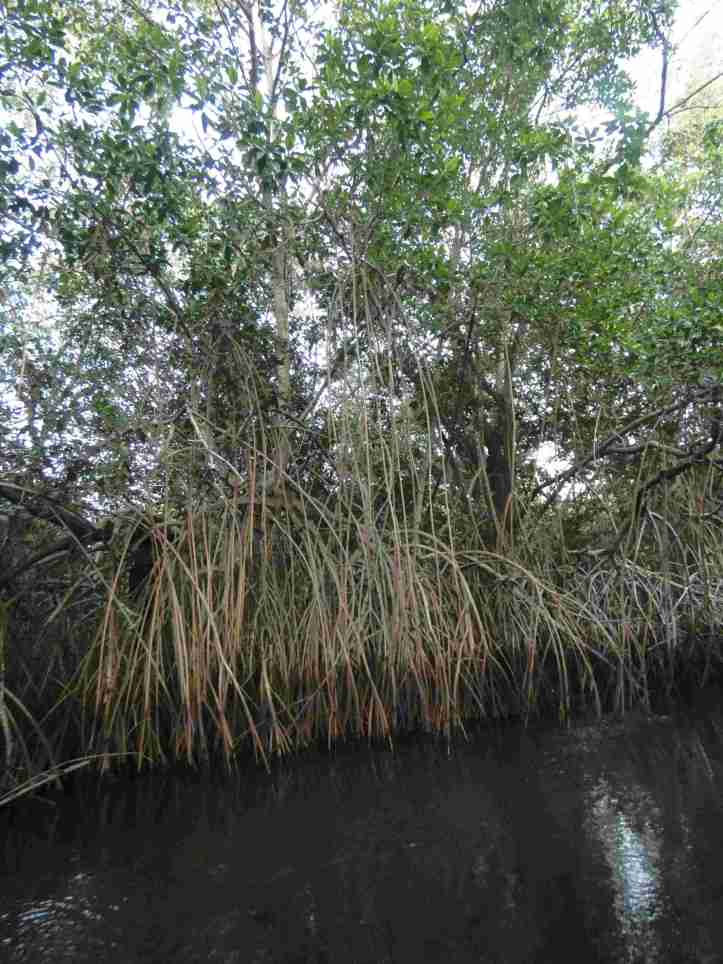
Instead I took several excursions through the the Red Mangrove forest. This section is part of the largest Red Mangrove system in Mexcio, that stretches from south of Mazatlan to Puerte Vallarte. Although it doesn’t crack the top 10 for mangrove forests, it is quite large and offers opportunities to see inside the forest, rather than just the edges. To start, I took a “panga” up the Rio Cristobal river to Laguna de Zoquipan. Some tourists come this way, but mostly biologists, birders, and scientists. This is a pristine lagoon and only in the last few decades have discovered an elusive species living here. Time and focus are different in an estuary like this. Watching life unfold away from human influence was quite spectacular.

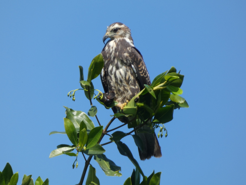
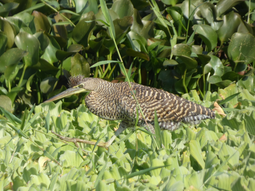
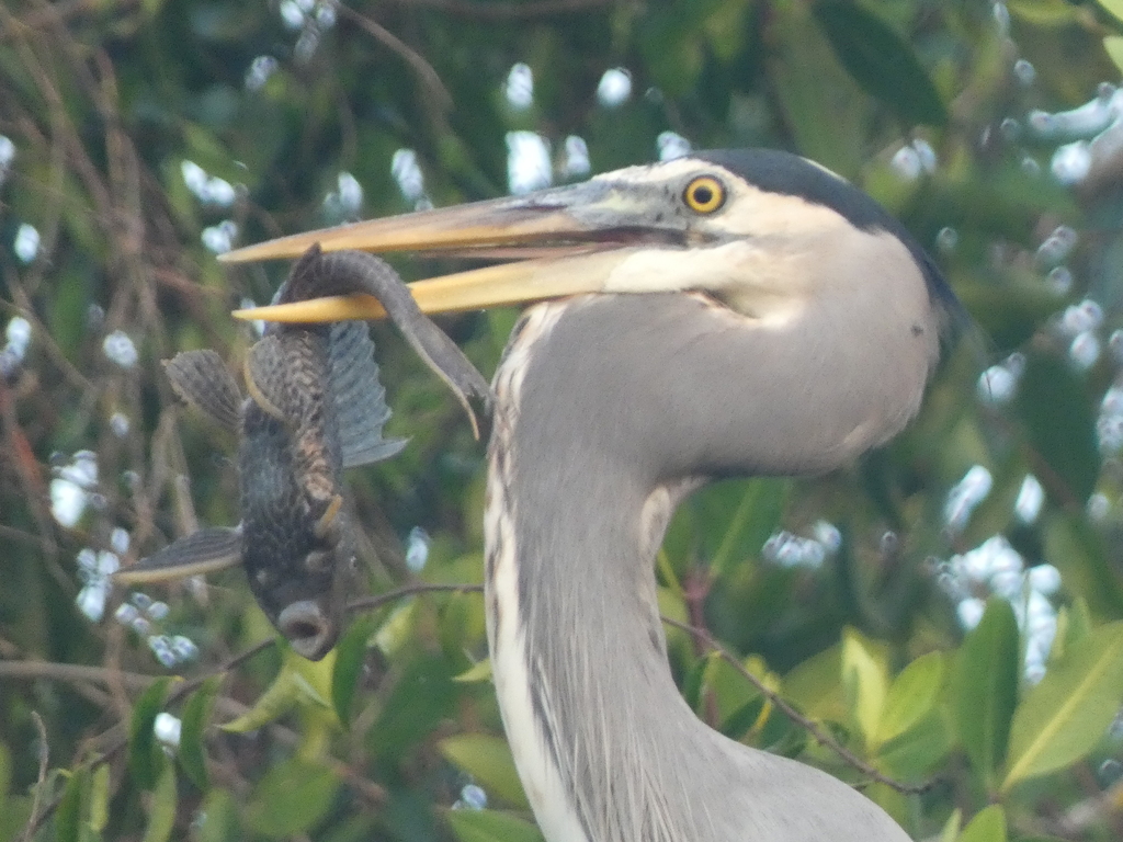
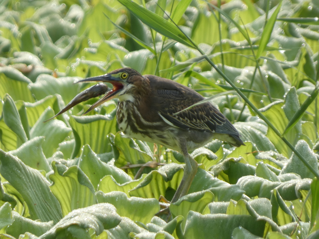
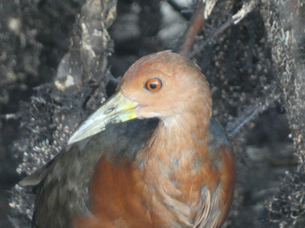
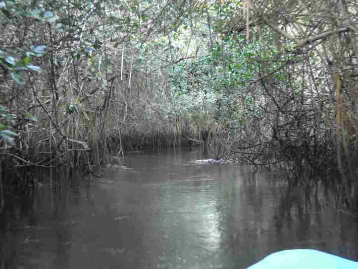
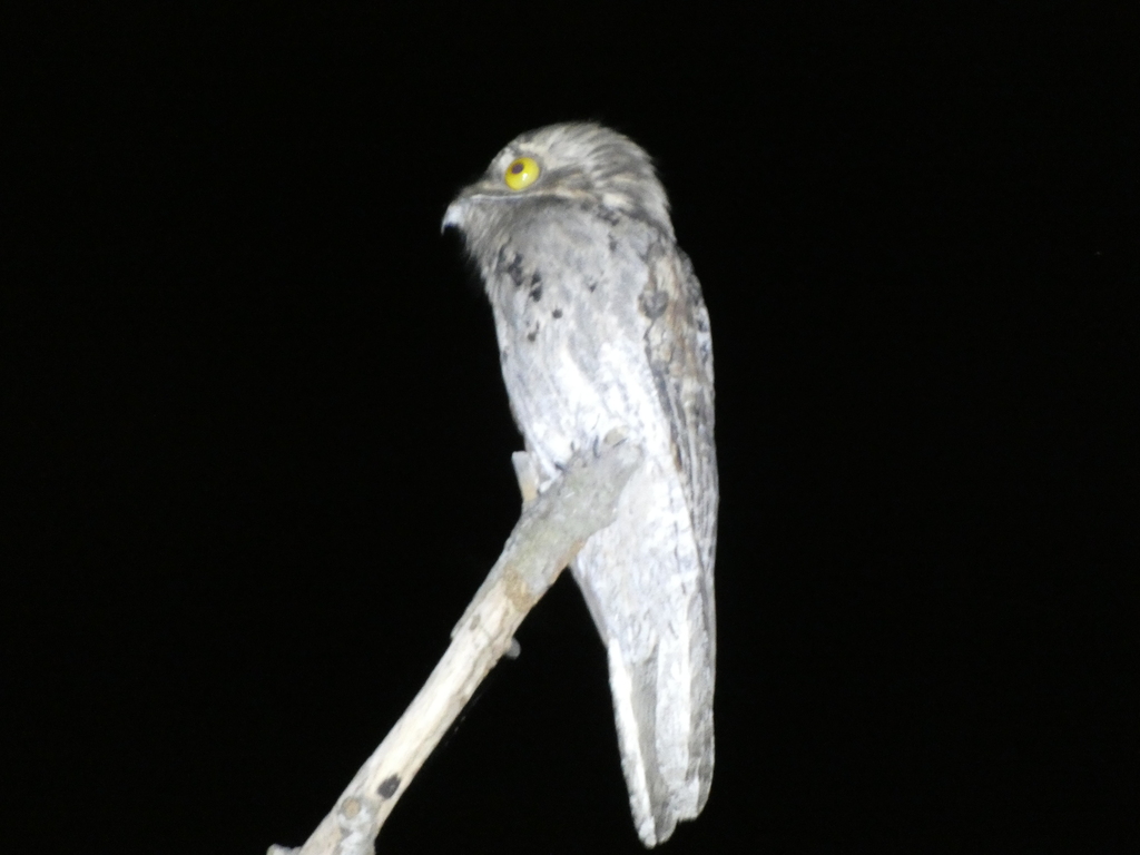
La Tovara National Park lies just downstream along the Rio Cristobal, just off the Estero Cristobal. Here I had a change to enter the red mangrove forest from the inside. It felt like entering somewhere where I did not belong. It was dark, the tide was low, so the sulfur from the mud, mangrove crabs ran up and down the mangrove tentacles. Kingfishers, rails, and boat billed herons dotted the channel. As we exited the mangrove canopy, with navigated through floating islands of grass, as birds started to roost. As night fell, Potoos and Pauraque calls filled the night.

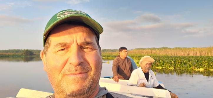
A special thanks goes out to Don Chenco (Who has been captaining a panga on the river for more than 20 years, and has lived on the river’s edge for over 50.) This type of ecotourism allowed him to move from working in a concrete factory to something more sustainable. He has several boats and knows every inch of the river, its inlets, tributaries, and is a fabulous knowledge guide to this part of the world.
What does the future hold for San Blas? Well, in talking with people who have lived in San Blas for many years there are far more people. There is quite a bit of sprawl. As once massive and popular hotels go vacant, they are left blighted and new ones are built. In the small town of Chacalila several of the lagoons and naturals forests that were there just 5 years ago are now gone, replaced by Jackfruit and Mango farms, while horses and livestock have killed several of the local lagoons. All of that is just up the hill of Laguna Zoquipan. I am grateful to have experienced it while I can and see some of the natural splendor that still exists.

This looks amazing! Love to you
LikeLike
Proud of you for making this trip. Love you!
LikeLike