Petra has always been one of those mystical places….giant carved stone palaces in the middle of the desert. This was the major reason we came to Jordan.
Petra has been a UNESCO World Heritage Site since 1983. I knew almost nothing about it so we spent time in the visitor center and the Petra Museum to learn more. Both were free and afforded an amazing lens back through time to this area.

History
Evidence in both the visitor center and the Petra Museum suggests there has been human activity in the area since the stone age (8500BC). However, the Nabataeans put Petra on the map! A powerful tribe of masterful Arab traders, they repelled Alexander the Great and used diplomacy and their wealth to stave off the Romans.
Aside from their architectural prowess, they used a highly sophisticated irrigation system with cisterns to collect water. In the desert water was worth its weight in gold. They used this along with their position along the trade routes to the Silk Road to increase their wealth and status. So famous and renown was this ancient city (then called Rekem or Rekmu), that it was recorded in the annals of Chinese History by Chang Chen envoy to emperor Wu Ti (138-122BC), as well as Greek, Roman, Egyptian, and Byzantine records.
When the last Nabataean king died, the area became a protectorate of Rome and was renamed Arabia Petrea. During this time there was even more building done. Sometime around the 4th century AD the Nabataeans moved out of Petra, by the 8th century AD there was no evidence of a civilization living there (Citation). The official story was that they walked away from the city leaving in an organized fashion (Citation). Sometime between the great quakes of 331AD and 551AD and the beginning of the 7th century, the city was abandoned (Citation) and no one knows why for sure.
However, the Bedouin people have most likely called Petra home for countless generations. The Nabataean tombs were looted long ago, leaving ready made caves for people to inhabit. In fact, in every tomb and cave we entered there was evidence of fires and habitation.
A day of hiking
Our original plan was to hike:
- The main trail to the Treasury
- Hike the high view trail (Al-Khubtha Trail)
- Hike to the high place of sacrifice back to the theater via to Wadi Farasha trail
However, we ended up hiking:
- The main trail (8.6 KM round trip)
- The High View Trail: Al-Khubtha Trail (3.5 KM round trip)
- The Monastery Trail: Al Deir Trail (2.5 KM round trip)
Even though it seems like a a measly 9 miles or so, two of the trails were rated hard. Everyone were champs the whole way and did amazingly well.
Awesome sights
After the visitor center we descended along the path and encountered giant Djinn blocks. Although not for certain, they believe these blocks were funerary blocks as opposed to god worship blocks (Citation: Click here )

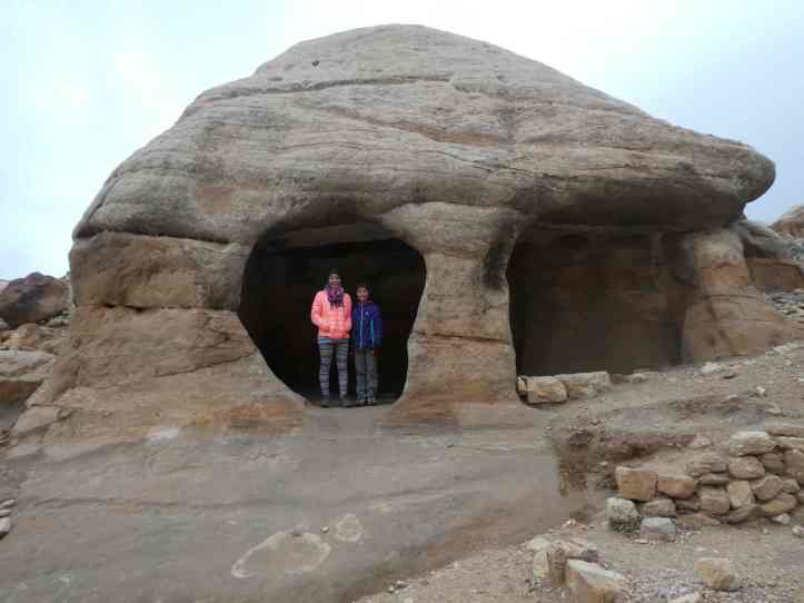
Around here we encountered our first tomb. The four pyramids at top were for the four buried souls within.

Along the ways there were plenty of small caves for the girls to play in.
We crossed a bridge over a river bed, and the canyon rose up around us. We had entered the Siq. We were in awe of the sandstone walls that swallowed us as we walked in.

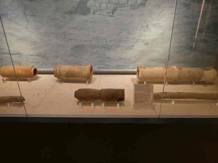
Along the walls of the Siq we saw what remained of ancient water collection methods. We had read about them in the visitor center and seeing them was truly remarkable.

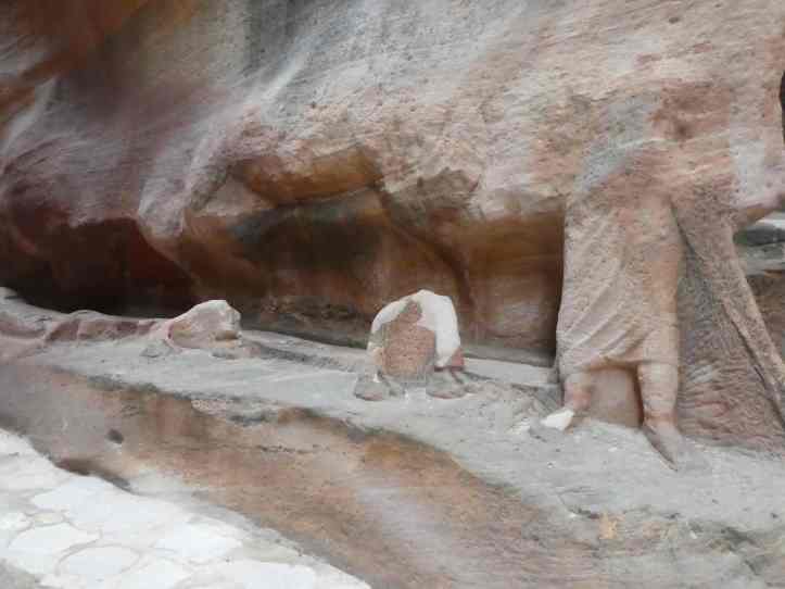
We walked along the Siq for nearly two kilometers admiring the water system, cobbled road, and carvings. Notable was a deteriorated carving of a trader with a camel caravan.
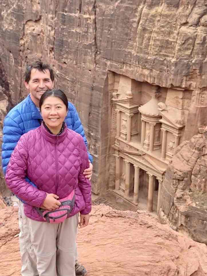
The Siq winds around and opens abruptly to a giant building: the Treasury. It is a tall and imposing building, 39.1 meters tall and 25.3 meters in width. The rose pink sandstone pops out against the blackened sandstone around it.
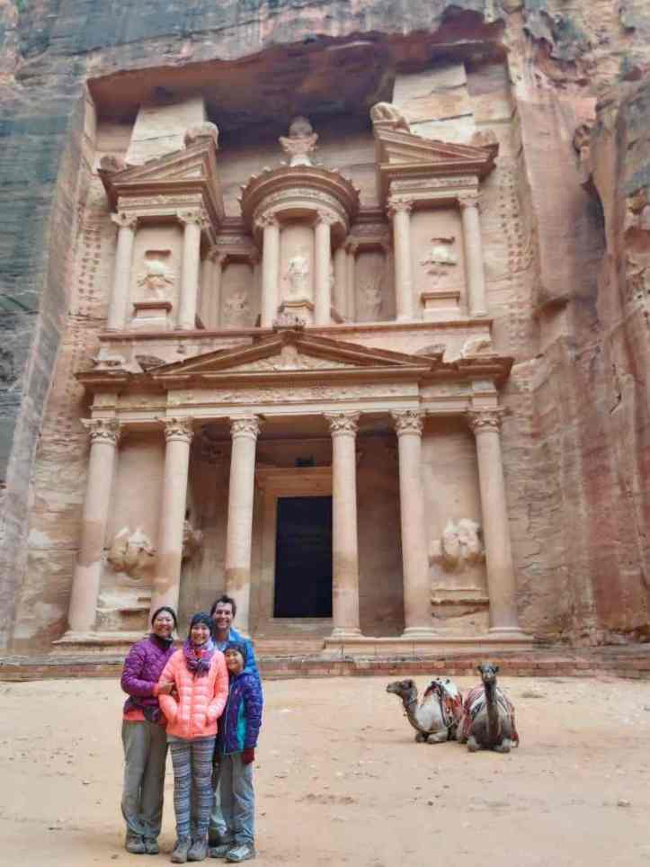

There were plenty of Bedouins offering camel and donkey rides. There was also carriage rides to and from the Treasury for those with mobility problems. The animals here are worked quite a bit harder than elsewhere. Often they bear sores from overworking.

The canyon opened to the street of facades. Countless tombs lined the road.
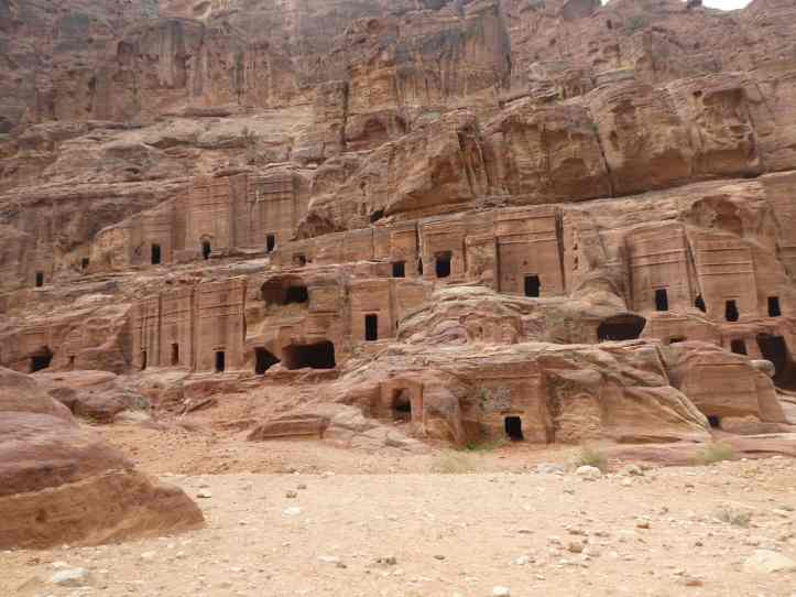
We started up the High View Trail and walked by more of these tombs.

We entered the Urn Tomb and were captivated by the colored ceiling.

Along the way we ran into a frankincense and myrrh salesman. The Nabataeans did not cultivate the soil or do any organized agriculture: “It is their custom neither to plant grain, set out any fruit-bearing tree, use wine, nor construct any house; and if anyone is found acting contrary to this, death is his penalty. ” from the Histories by Diodorus. The Nabataeans made their fortunes on trading. The most valuable items in ancient times (aside from water in the desert), were frankincense and myrrh. It was amazing to see some. We learned that both of these were sap from different trees. Sadly the trees that produce frankincense are in decline and estimates state that 90% of the tree population will be gone in the next 50 years due to over harvesting. After thousands of years this product may disappear. (Citation)
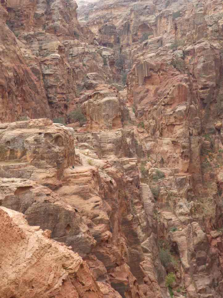
On the way up we saw erosion from time first hand. Many hideaways provided the perfect locations for Kylie.

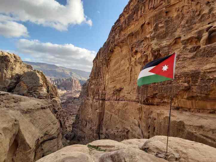
At the top we were able to look down at the Theater that was constructed in the first century. An incredible carving out of the mountain.

Along the way we had to walk up steps that were carved into the mountainside over 2000 years ago. Some steps really held up over time.

At the end of the trail we were treated to an aerial view of the Treasury.

We went back down the trail, passing donkeys and other tourists coming up. We changed our plan and decided to head out to the Monastery along the Al Deir trail. Bedouin trading stalls lined the steep path.

The Monastery was the perfect way to end the day as the sunset gave it a rose hue. I climbed up to a view point where there were circular patterns in the earth as well as many cut outs in the cliffs facing the temple. Clearly this was an ancient space used for centuries, and now no one knows exactly the purposes of all it. We spent time in the museum learning more about Nabataean culture, but in the end they walked away and faded into the landscape leaving the Romans, Greeks, and Egyptians to tell their story as there was very little Nabataeans writing left behind. All we could do was admire their work.


[…] Mulu. We saw both amazing human accomplishments (like the Pyramids of Egypt, The Great Wall, Petra, Borobudur, My Son and many more) and some of the worst human failures like air quality in India, […]
LikeLike